Route highlights
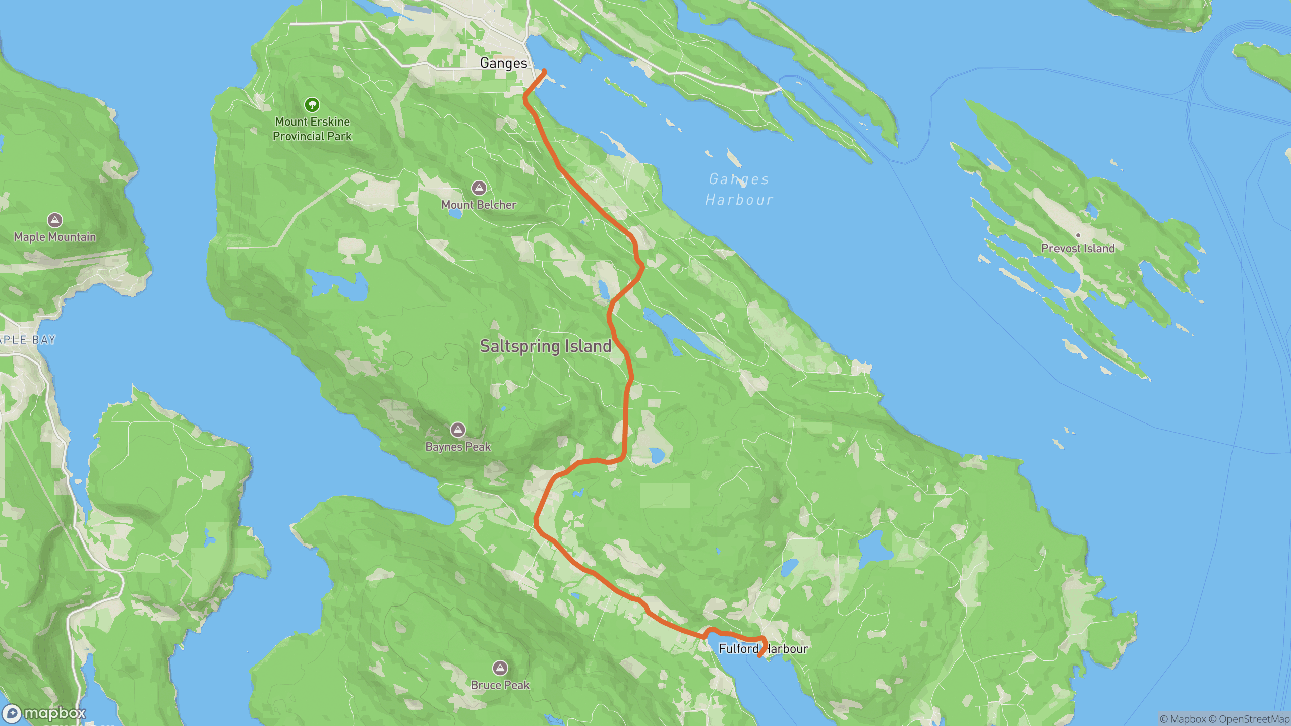
The drive breaks into 3 distinct sections.
1
Fulford Harbour
Straight off the ferry ramp into immediate corners along the harbour head.
2
Central valley
Rolling farm-and-forest bends past Burgoyne Bay turnoffs — the rhythm section.
3
Into Ganges
A final descent into Salt Spring's main village and harbour.
AD
ad slot (responsive banner)
Before you go
Best time
Time it with a BC Ferries sailing from Swartz Bay; early sailings mean an empty road.
Watch for
Deer at dawn and dusk, and ferry-rush pulses of traffic right after each sailing.
Worth a stop
Salt Spring Saturday Market in Ganges; Mount Maxwell lookout detour.
Fuel & food
Fuel and plenty of food in Ganges.
Drive it with REVV
Turn-by-turn route guidance built for scenic drives — launching soon on iPhone.
Join the waitlist
AD
ad slot (responsive banner)